
Home
››
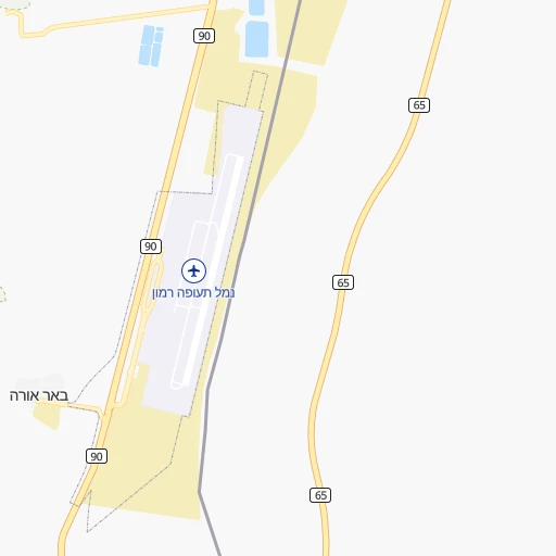
Eilat/Ramon International Airport
››
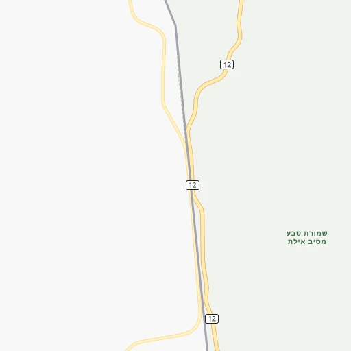
Roadmap from Eilat/Ramon International Airport to Modiin Ilit
How to get from Eilat/Ramon International (airport) (Southern District) to Modiin Ilit (Jerusalem)
Calculate route from Eilat/Ramon International (airport) (Southern District, Israel) to Modiin Ilit (Jerusalem, Israel).
The flight distance (as the crow flies) between Eilat/Ramon International (airport) and Modiin Ilit is 245.2 km.
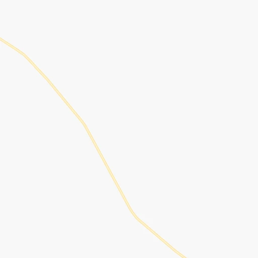
Roadmap (route) to go from Eilat/Ramon International Airport to Modiin Ilit detailed above, you can also see the course layout on the map.
While doing trip Eilat/Ramon International (airport) - Modiin Ilit by car, the calculated route ends at a distance , or more straight.
Distance and duration of the route between Eilat/Ramon International (airport) and Modiin Ilit
Calculation of distance and route from Modiin Ilit to Eilat/Ramon International (airport) :
245.2311.7 km4h11mn
Continue 0h0mn 110 mKeep right 0h1mn 424 mAt roundabout, take exit 1 0h0mn 255 mAt roundabout, take exit 1 0h1mn 1.1 kmAt roundabout, take exit 1 0h1mn 663 mAt roundabout, take exit 1 0h1mn 647 mKeep right 0h26mn 33.4 kmTurn left onto 40 0h29mn 38.2 kmTurn left onto 40 1h48mn 59.2 kmAt roundabout, take exit 1 onto שדרות קק"ל 0h0mn 221 mAt roundabout, take exit 2 onto שדרות קק"ל 0h1mn 1.1 kmAt roundabout, take exit 2 onto 40 0h30mn 34.7 kmTurn left onto 40 0h12mn 13.5 kmKeep right onto 40 0h22mn 26.0 kmKeep left onto 40 0h0mn 69 mContinue onto 406 0h6mn 6.2 kmKeep right 1h43mn 62.9 kmKeep right and take 3 toward ירושלים, קריית מלאכי 0h1mn 699 mKeep right and take 3 toward ירושלים 0h12mn 15.9 kmAt roundabout, take exit 2 onto 3 0h3mn 3.0 kmAt roundabout, take exit 2 onto שדרות החשמונאים 0h8mn 8.1 kmTurn left onto 443 0h0mn 59 mKeep right 0h2mn 2.9 kmTurn right 0h0mn 57 mTurn left 0h0mn 220 mKeep right 0h1mn 502 mContinue onto הרב הולנדר יצחק 0h1mn 567 mTurn right onto מסילת ישרים 0h0mn 156 mAt roundabout, take exit 2 onto חפץ חיים 0h0mn 102 mAt roundabout, take exit 2 onto חפץ חיים 0h0mn 342 mAt roundabout, take exit 2 onto חפץ חיים 0h0mn 130 mTurn left onto שער המלך 0h0mn 44 mTurn right onto מנחת חינוך 0h0mn 202 mArrive at destination 0h0mn 0 m
Travel from Eilat/Ramon International (airport) (Jerusalem) to a selection of major cities.
Distances from Eilat/Ramon International Airport to biggest cities in Southern District
Other major cities in country :
Route from Modiin Ilit to major cities (Israel).
- Distance Modiin Ilit Tel Aviv30 km
- Distance Modiin Ilit Haifa99 km
- Distance Modiin Ilit Ashdod40 km
- Distance Modiin Ilit Rishon LeZiyyon24 km
- Distance Modiin Ilit Petah Tiqwa23 km
- Distance Modiin Ilit Beersheba79 km
- Distance Modiin Ilit Netanya48 km
- Distance Modiin Ilit Holon26 km
- Distance Modiin Ilit Bnei Brak26 km
- Distance Modiin Ilit Rehovot22 km
- Distance Modiin Ilit Bat Yam29 km
- Distance Modiin Ilit Ramat Gan28 km
- Distance Modiin Ilit Ashkelon53 km
- Distance Modiin Ilit Jaffa31 km
- Distance Modiin Ilit Modi'in Makkabbim Re'ut5 km
- Distance Modiin Ilit Herzliya33 km
- Distance Modiin Ilit Kfar Saba30 km
- Distance Modiin Ilit Ra'anana32 km
- Distance Modiin Ilit Hadera58 km
- Distance Modiin Ilit Lod15 km
Nearest cities to Eilat/Ramon International (airport) :
- Jerusalem, 801,000 inhabitants. 228 km
- Tel Aviv, 432,892 inhabitants. 263 km
- West Jerusalem, 400,000 inhabitants. 230 km
- Ashdod, 224,656 inhabitants. 233 km
- Rishon LeZiyyon, 220,492 inhabitants. 251 km
- Petah Tiqwa, 200,000 inhabitants. 263 km
- Beersheba, 186,600 inhabitants. 171 km
- Netanya, 171,676 inhabitants. 291 km
- Holon, 165,787 inhabitants. 255 km
- Bnei Brak, 154,400 inhabitants. 263 km
- Rehovot, 132,671 inhabitants. 242 km
- Bat Yam, 128,979 inhabitants. 257 km
- Ramat Gan, 128,095 inhabitants. 263 km
- Ashkelon, 105,995 inhabitants. 220 km
- Jaffa, 100,000 inhabitants. 260 km
- Modi'in Makkabbim Re'ut, 88,749 inhabitants. 241 km
- Herzliya, 83,600 inhabitants. 272 km
- Kfar Saba, 80,773 inhabitants. 273 km
- Ra'anana, 80,000 inhabitants. 274 km
- Hadera, 75,854 inhabitants. 303 km
- Bet Shemesh, 67,100 inhabitants. 223 km
- Lod, 66,589 inhabitants. 248 km
- Nazareth, 64,800 inhabitants. 332 km
- Modiin Ilit, 64,179 inhabitants. 246 km
- Ramla, 63,860 inhabitants. 246 km
- Givatayim, 48,000 inhabitants. 262 km
- Qiryat Gat, 47,450 inhabitants. 211 km
- Eilat, 45,588 inhabitants. 20 km
- Afula, 44,930 inhabitants. 322 km
- Hod HaSharon, 43,185 inhabitants. 271 km
- Umm el Fahm, 41,030 inhabitants. 311 km
- Rosh Ha'Ayin, 39,215 inhabitants. 264 km
- Ness Ziona, 38,700 inhabitants. 246 km
- Kiryat Ono, 37,791 inhabitants. 260 km
- Ramat HaSharon, 36,137 inhabitants. 270 km
- Dimona, 33,558 inhabitants. 150 km
- Et Taiyiba, 32,978 inhabitants. 283 km
- Yavne, 31,774 inhabitants. 241 km
- Or Yehuda, 30,802 inhabitants. 257 km
- Yehud-Monosson, 29,312 inhabitants. 257 km
- Gedera, 26,217 inhabitants. 234 km
- Yehud, 25,600 inhabitants. 257 km
- Daliyat al Karmel, 25,000 inhabitants. 330 km
- Migdal Ha`Emeq, 24,800 inhabitants. 329 km
- Netivot, 24,564 inhabitants. 193 km
- Mevasseret Ziyyon, 24,409 inhabitants. 232 km
- Ofaqim, 24,311 inhabitants. 181 km
- Arad, 23,700 inhabitants. 172 km
- Gan Yavne, 22,453 inhabitants. 231 km
- Kefar Yona, 21,611 inhabitants. 289 km
Location Eilat/Ramon International (airport) (Southern District) :
| Country flag |  |
| Location | Eilat/Ramon International (airport) |
| State | Southern District |
| County | |
| Country | Israel |
| Country code / ISO 2 | IL |
| Latitude | 29.7255100 |
| Longitude | 35.0078500 |
| Altitude | 0 meters |
| Time zone | Asia/Jerusalem |
Location Modiin Ilit (Jerusalem) :
| Country flag | |
| Location | Modiin Ilit |
| State | Jerusalem |
| County | |
| Country | Israel |
| Country code / ISO 2 | IL |
| Latitude | 31.9322100 |
| Longitude | 35.0441600 |
| Altitude | 280 meters |
| Time zone | Asia/Jerusalem |